To Start learning GIS from scratch, you can follow the below steps:
ArcGIS Pro
Start Learning ArcGIS Pro which is a wonderful tool being used for creating feature
classes, and analyzing,
visualizing, and geoprocessing spatial data. The tool is very powerful that allows users
to deal with 2D and
3D Vector data types plus the Raster. GIS beginners use this tool to create polygons,
points, and line,
feature classes. The tool also allows users to perform some basic and advanced analyses
of spatial data.
QGIS
QGIS is another GIS tool that is being used by GIS developers to deal with Vector and
Raster data types
and it does almost the same tasks as ArcGIS Pro but learning it will certainly ease your
work and is a
privilege too.
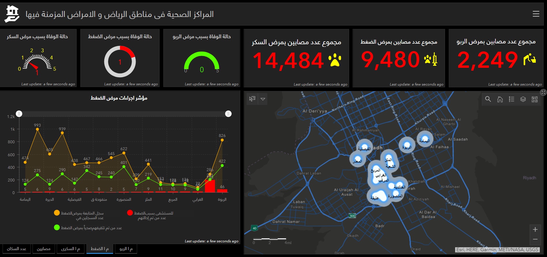
ArcGIS Online
After learning the two mentioned tools, users can also learn that ArcGIS Online tools
like Operational
Dashboards and Story Maps are used for data Visualization and to extract insights from
spatial data by
connecting them with maps, graphs, charts, sounds, and videos.
Along with the mentioned tools, it is necessary that you can use the Google Earth tool as
well.